Have you looked at a map online lately? Ever look up your property to see your parcel lines? If you have, you are probably more familiar with the term GIS than you think. Geographic Information System, or GIS, is the framework for gathering, managing, and analyzing data, and then organizing and creating a visual representation for you to look at, aka your parcel map.
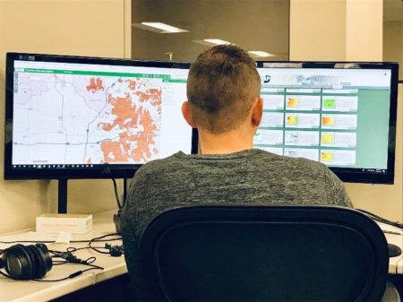
 Today is National GIS Day. A day dedicated to showing, teaching, learning and inspiring others to become excited about geography. So, here at Holland Engineering, we thought we would share with all of you some of the different ways we have used GIS in the past year. While most of our maps are visually pleasing to look at, there is a lot more to just the map. Behind the scenes, we are digging deep into the data, analyzing it and helping our clients make smarter decisions.
Cursory Review Maps – Typically, an environmental project starts with this set of mapping. Completing a desktop environmental review of the project area, to figure out the types of permits the project will need. Which then starts the discussion of how much a project is going to cost. Wetlands, floodplain, watercourses, and soils, are some of the environmental factors we review before starting a project.
Arc Collector for Field Collection
- Delineations – Before our Environmental Team completes a field check, the proposed workspace is uploaded to Arc Collector, so while in the field, they know the boundaries for the project. Using a tablet and GNSS receiver, they can delineate features in the field. While back in the office, we can see real-time data being collected.
- Aquatic Surveys – New this year, we completed our first mussel survey. In ArcMap we created plots along the creek. Then uploaded the layer into Arc Collector. Our biologist was then able to complete a more accurate survey, seeing precisely where she was located in the creek while collecting mussels.
NEPA Process Figures – An Environmental Assessment (EA) is part of the decision-making processes, that takes into consideration all environmental and socioeconomic effects of proposed actions. The EA analyzes potential environmental impacts of proposed actions and their alternatives for public understanding and examination, by avoiding or minimizing adverse effects of proposed actions, and restore and enhance environmental quality to the extent practicable. Our Environmental and GIS team has evaluated multiple projects in the past year.
Alignment Sheets – Using Lightning, a program created by Blue Sky Development, we were able to produce pipeline alignment sheets in ArcMap for several projects this year. Lightning is ideal for design, construction, as-built and maintenance projects.
If you have questions about how GIS can benefit you, or if you have general GIS inquiries, email GIS@hollandengineering.com or call our Holland, MI office at (616) 392-5938.