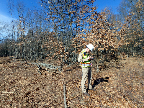
Our GIS and Environmental Groups have found a way to make data collecting more efficient. Using the Collector for ArcGIS App, Holland Engineering has expedited the process of collecting and uploading data from the field. Collector allows our GIS Team to upload layers, such as workspace or right-of-way, directly to the app. Our Environmental Group then can easily see where delineations are needed. While in the field, our Environmental Group can collect points, lines, and areas. But wait, there’s more! They can also take photos and fill out forms in the field that can be linked to the features collected. Using the Collector App cuts down the time from having to upload raw data and make proper conversions, scan field paperwork, and edit photos.
Our Team uses a tablet for the App interface and connects to a Trimble R1 receiver through Bluetooth to provide a professional grade location service. The Trimble R1 is a Global Navigation Satellite System (GNSS) receiver and is capable of using various navigation satellite systems to achieve sub-meter accuracy.
Real-time data is an added plus. In the office, team members can see the data being collected as field members work throughout the day. And if there is a change in the workspace, the GIS Group can quickly modify the layer in the app, and the Environmental Group can adjust their day to the changes made.
All of our recent updates using ArcGIS Online, ArcGIS for Server, and Collector for ArcGIS App, are making the field data collection a seamless process. Holland Engineering is redefining how our teams work together, increasing productivity, and giving our clients better, more accurate results.
Follow this link for an inside look at how we use the Collector for ArcGIS App.
If you have questions about how Collector for ArcGIS App can benefit you, or if you have general GIS inquiries, email GIS@hollandengineering.com or call our Holland, MI office at (616) 392-5938.